$2,900,000
9440 114th Street
Ocala, FL 34481
Property type
Lot size
Price / sq ft
HOA dues
Days on market
Flood zone
About this home
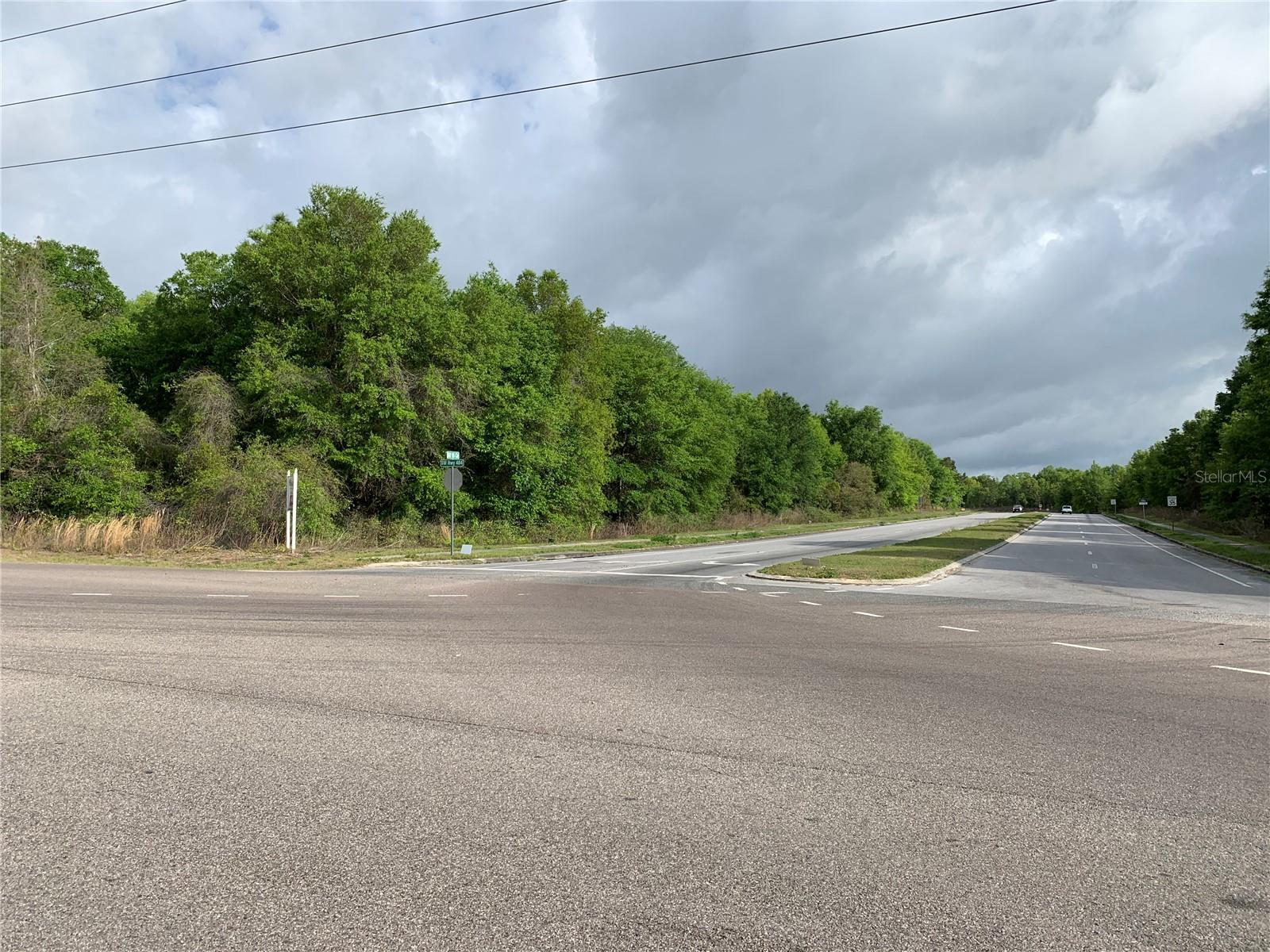
16.99 ac, outparcel of 1-3 acres can be created. Property is Zoned B4, and the Marion County Parcel ID is 35341-001-19. Hwy 484 and SW Hwy 200 combined traffic count is 27,800 cars each day (FDOT 2022). Property is adjacent to Walmart and Bealls. Seller Financing available.
Estimated monthly payment
Estimate only. Taxes use the listing's reported amount where available; insurance is a Florida-average estimate. Your actual payment will vary — run a full calculation or talk to a lender.
Price & listing history1336 days on market
- Status: ActiveJan 2, 2024
- Listed$2,900,000Oct 8, 2021
- Price increased$2,900,000
Virtual Tour
Facts & features
- Property type
- Land
- Status
- Active
- Days on market
- 1336
- Cumulative DOM
- 1520
- Subdivision
- Marion Center
- County
- Marion
- Price/sq ft
- $4
- Lot size
- 740,084 sq ft
- Lot category
- 10 to less than 20
- Flood zone
- X
- Annual taxes
- $1,158 (2021)
- Parcel #
- 35341-001-19
- Zoning
- B4
- MLS #
- OM628474
Interior Details
- Direction faces
- South
HOA & Financial
- Total monthly fees
- $0/mo
- Total annual fees
- $0
- Ownership
- Other
Exterior & Construction
- Road surface
- Asphalt
Utilities
- Sewer
- None
- Water source
- None
- Utilities
- Other
Listing Details
- Listing date
- 2021-10-08
- On market date
- 2021-10-08
- Original list price
- $2,900,000
- MLS area
- 34481 - Ocala
- Listing AOR
- Lake and Sumter
- Status changed
- 2024-01-02
- Tax legal description
- SEC 35 TWP 16 RGE 20 PLAT BOOK 009 PAGE 039 MARION CENTER TRACTS 2.3.EXCEPT PART OF TRACT 2 DESCRIBED AS FOLLOWS: COM AT NE COR OF SEC 35 TH RUN S 89-16-55 W 1542.52 FT, TH S 41-39-25 W 1429.68 FT, TH S 33-45-10 W 100.96 FT, TH S 41-39-25 W 1512.07 F T TO POB, PT BEING PT OF CUSP OF CURVE CONCAVE SELY, RADIUS 25 FT, TH ALONG ARC OF CURVE 39.27 FT TO PT OF TANGENCY, TH S 48-20-36 E 703.70 FT TO PT OF CURVATURE OF CURVE TO NE, TH ALONG ARC OF CURVE TO LEFT 63.37 FT TO PT TH S 41-39-25 W 673.03 FT T O PT OF NONTANGENCY OF A CURVE CONCAVE TO S & NLY ROW LINE OF CR 484, TH ALONG ARC OF CURVE TO LEFT 143.42 FT TO PT ON NELY LINE OF WRA TH N 55-42-11 W 688.11 FT TO SLY ROW LINE OF SR200 TH N 41-39-25 E 826.07 FT TO POB
Flood risk
Minimal-risk area outside the mapped floodplain. Flood insurance is optional and typically low-cost.
Source: FEMA flood zone reported on the listing. Confirm current designation at FEMA Flood Map Service Center.
Location
Directions
Hwy 484 and SW Hwy 200, adjacent to Walmart and Bealls.
More homes like this
$1,850,000
12424 Sw 140th Loop
Dunnellon, FL 34432
4 bd · 4 ba · 3,801 sqft
Bel Lago South Hamlet
MLS# OM721770
$3,649,900
7119 Sw 80th Ave
Ocala, FL 34481
3 bd · 2 ba · 1,620 sqft
N/A
MLS# O6309705
$3,750,000
5350 Sw College Rd
Ocala, FL 34474
5.21 acres
Heathbrook South B-2
MLS# A4670024
Listings courtesy of Stellar MLS as distributed by MLS GRID
IDX information is provided exclusively for consumers’ personal, non-commercial use and may not be used for any purpose other than to identify prospective properties consumers may be interested in purchasing.
Based on information submitted to the MLS GRID as of December 12, 2025 at 2:40 PM ET. All data is obtained from various sources and may not have been verified by broker or MLS GRID. Supplied Open House Information is subject to change without notice. All information should be independently reviewed and verified for accuracy. Properties may or may not be listed by the office/agent presenting the information.
Ryan Solberg, Broker · MaxLife Realty LLC · FL License #BK3354351 · Equal Housing Opportunity · Full disclaimer · DMCA