$1,000
225 Maple Street
Interlachen, FL 32148
Property type
Lot size
Price / sq ft
HOA dues
Days on market
Flood zone
About this home
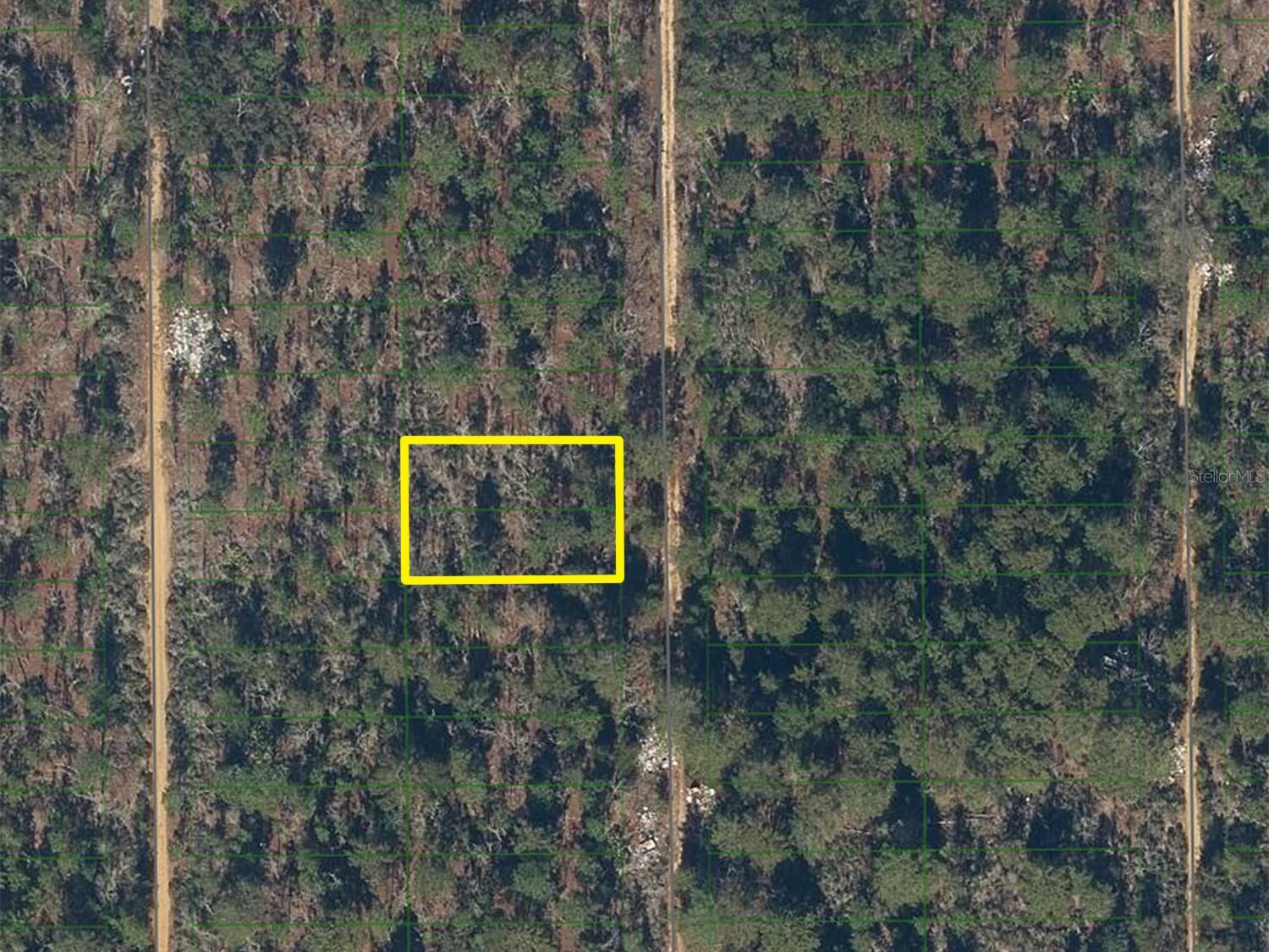
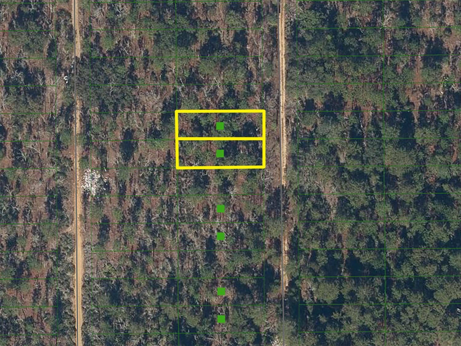
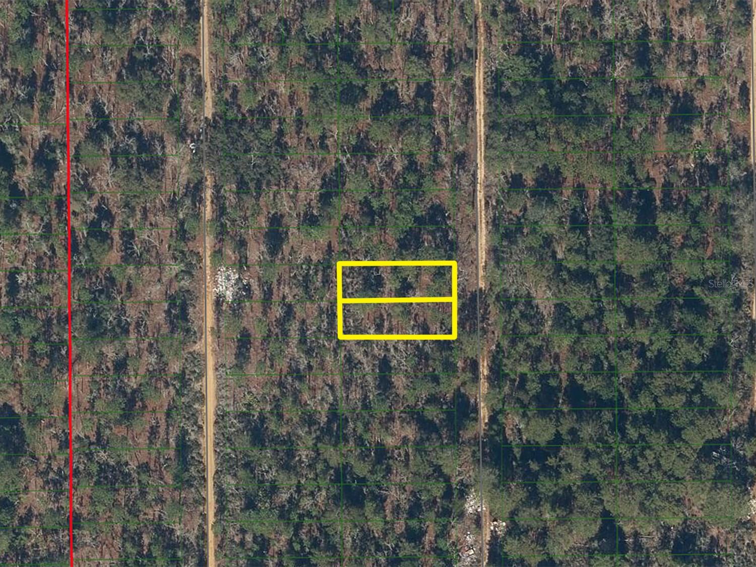
Auction Property. Multi-lot online auction featuring 9 residential land parcels located throughout Interlachen, Florida in Putnam County. Multi-lot Auction Begins: May 29, 2026 at 10:00 AM ET. Auction Ends: June 2, 2026 from 12:00 PM through 12:40 PM ET. List Price is Suggested Opening Bid. +/- 0.22 Acre vacant parcel of land located in Interlachen, Florida. Approximately 8 miles to Rodman Reservoir and 27 miles to Ocala National Forest. SR 20 provides highway connectivity. Parcel ID Numbers: 04-10-24-6450-0060-0270 & 04-10-24-6450-0060-0260
Estimated monthly payment
Estimate only. Taxes use the listing's reported amount where available; insurance is a Florida-average estimate. Your actual payment will vary — run a full calculation or talk to a lender.
Price & listing history43 days on market
- Status: ActiveApr 7, 2026
- Listed$1,000Apr 7, 2026
- Price increased$1,000
Facts & features
- Property type
- Land
- Status
- Active
- Days on market
- 43
- Subdivision
- Oak Hills Estates Sub
- County
- Putnam
- Price/sq ft
- $0
- Lot size
- 4,792 sq ft
- Lot category
- 0 to less than 1/4
- Flood zone
- X
- Annual taxes
- $50 (2025)
- Parcel #
- 04-10-24-6450-0060-0270
- Zoning
- R
- MLS #
- O6396938
HOA & Financial
- Total monthly fees
- $0/mo
- Total annual fees
- $0
- Ownership
- Other
Exterior & Construction
- Road surface
- Other
Utilities
- Sewer
- None
- Water source
- None
- Utilities
- Other
Listing Details
- Listing date
- 2026-04-07
- On market date
- 2026-04-07
- Original list price
- $1,000
- Special conditions
- Auction
- MLS area
- 32148 - Interlachen
- Listing AOR
- Orlando Regional
- Status changed
- 2026-04-07
- Tax legal description
- OAK HILLS ESTATES S/D MB4 P45 BLK F LOT 27
Flood risk
Minimal-risk area outside the mapped floodplain. Flood insurance is optional and typically low-cost.
Source: FEMA flood zone reported on the listing. Confirm current designation at FEMA Flood Map Service Center.
Location
Directions
Strickland Rd onto Route 315. From Holly Trail onto Cedar Trail. From Cedar Trail onto Maple St. Please reference GIS and GPS for exact coordinates.
More homes like this
Listings courtesy of Stellar MLS as distributed by MLS GRID
IDX information is provided exclusively for consumers’ personal, non-commercial use and may not be used for any purpose other than to identify prospective properties consumers may be interested in purchasing.
Based on information submitted to the MLS GRID as of May 20, 2026 at 3:46 PM ET. All data is obtained from various sources and may not have been verified by broker or MLS GRID. Supplied Open House Information is subject to change without notice. All information should be independently reviewed and verified for accuracy. Properties may or may not be listed by the office/agent presenting the information.
Ryan Solberg, Broker · MaxLife Realty LLC · FL License #BK3354351 · Equal Housing Opportunity · Full disclaimer · DMCA