$1,200,000
15820 County Road 675
Parrish, FL 34219
Property type
Lot size
Price / sq ft
HOA dues
Days on market
Flood zone
About this home
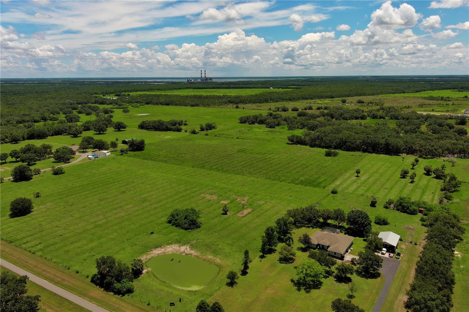
Calling all investors, farmers and entrepreneurs on this beautiful 25-acre parcel! Ready to go! Fenced and includes a Well. Sellers motivated! Rare piece of land in Parrish.
Estimated monthly payment
Estimate only. Taxes use the listing's reported amount where available; insurance is a Florida-average estimate. Your actual payment will vary — run a full calculation or talk to a lender.
Price & listing history297 days on market
- Status: ActiveMay 14, 2026
- Listed$1,200,000Jul 12, 2025
- Price increased$1,200,000
Virtual Tour
Facts & features
- Property type
- Land
- Status
- Active
- Days on market
- 297
- County
- Manatee
- Price/sq ft
- $1
- Lot size
- 1,089,087 sq ft
- Lot category
- 20 to less than 50
- Flood zone
- AE,X
- Annual taxes
- $299 (2024)
- Parcel #
- 495014059
- Zoning
- A1
- MLS #
- A4657953
HOA & Financial
- Total monthly fees
- $0/mo
- Total annual fees
- $0
- Listing terms
- Cash
- Ownership
- Fee Simple
Exterior & Construction
- Road surface
- Dirt
Utilities
- Sewer
- None
- Water source
- Well
- Utilities
- Water Available
Listing Details
- Listing date
- 2025-06-22
- On market date
- 2025-07-12
- Original list price
- $1,200,000
- MLS area
- 34219 - Parrish
- Listing AOR
- Sarasota - Manatee
- Status changed
- 2026-05-14
- Tax legal description
- PARCEL 16-A: TH N 892.97 FT OF THE FOLLOWING: A PARCEL OF LAND IN SEC 26 & 35, MORE DESC AS FOL: COM AT THE NW COR OF SD SEC 35; TH S 01 DEG 46 MIN 22 SEC E, ALG THE W LN OF SD SEC 35, A DIST OF 310.62 FT TO A PT ON THE NLY MONUMENTED R/W LN OF RUTLA ND RD (MANAEE CO RD #675), SD PT BEING A PT ON A CURVE, CONCAVE TO THE NE, HAVING A RAD OF 3362.75 FT; TH SELY ALG THE
Flood risk
FEMA Special Flood Hazard Area (1% annual-chance / “100-year” floodplain). Flood insurance is generally required by mortgage lenders.
Source: FEMA flood zone reported on the listing. Confirm current designation at FEMA Flood Map Service Center.
Location
Directions
Head north on US-301. Turn right on CR 675. Parcel of land will be on left.
More homes like this
$835,000
10019 Degas Ter
Bradenton, FL 34212
3 bd · 3 ba · 2,240 sqft
Watercolor Place
MLS# A4692406
$1,100,000
14109 9th Ter Ne
Bradenton, FL 34212
3 bd · 3 ba · 2,800 sqft
Winding River
MLS# A4691130
$950,000
12810 Daisy Pl
Bradenton, FL 34212
4 bd · 4 ba · 3,141 sqft
Greyhawk Landing Ph 3
MLS# A4678877
$1,050,000
5027 Lake Toscana Dr
Wimauma, FL 33598
4 bd · 4 ba · 3,072 sqft
Riverranch Preserve
MLS# TB8461199
Listings courtesy of Stellar MLS as distributed by MLS GRID
IDX information is provided exclusively for consumers’ personal, non-commercial use and may not be used for any purpose other than to identify prospective properties consumers may be interested in purchasing.
Based on information submitted to the MLS GRID as of May 15, 2026 at 7:17 AM ET. All data is obtained from various sources and may not have been verified by broker or MLS GRID. Supplied Open House Information is subject to change without notice. All information should be independently reviewed and verified for accuracy. Properties may or may not be listed by the office/agent presenting the information.
Ryan Solberg, Broker · MaxLife Realty LLC · FL License #BK3354351 · Equal Housing Opportunity · Full disclaimer · DMCA