
$60,000
736 Sickle Point
Inverness, FL 34450
Listing updated: August 28, 2026 at 7:42 AM ET
Listing courtesy of Era Grizzard Real Estate · Ricky Harper · MLS #G5108952 · Active · 352-787-6966Property type
Lot size
Price / sq ft
HOA dues
Days on market
Flood zone
About this home
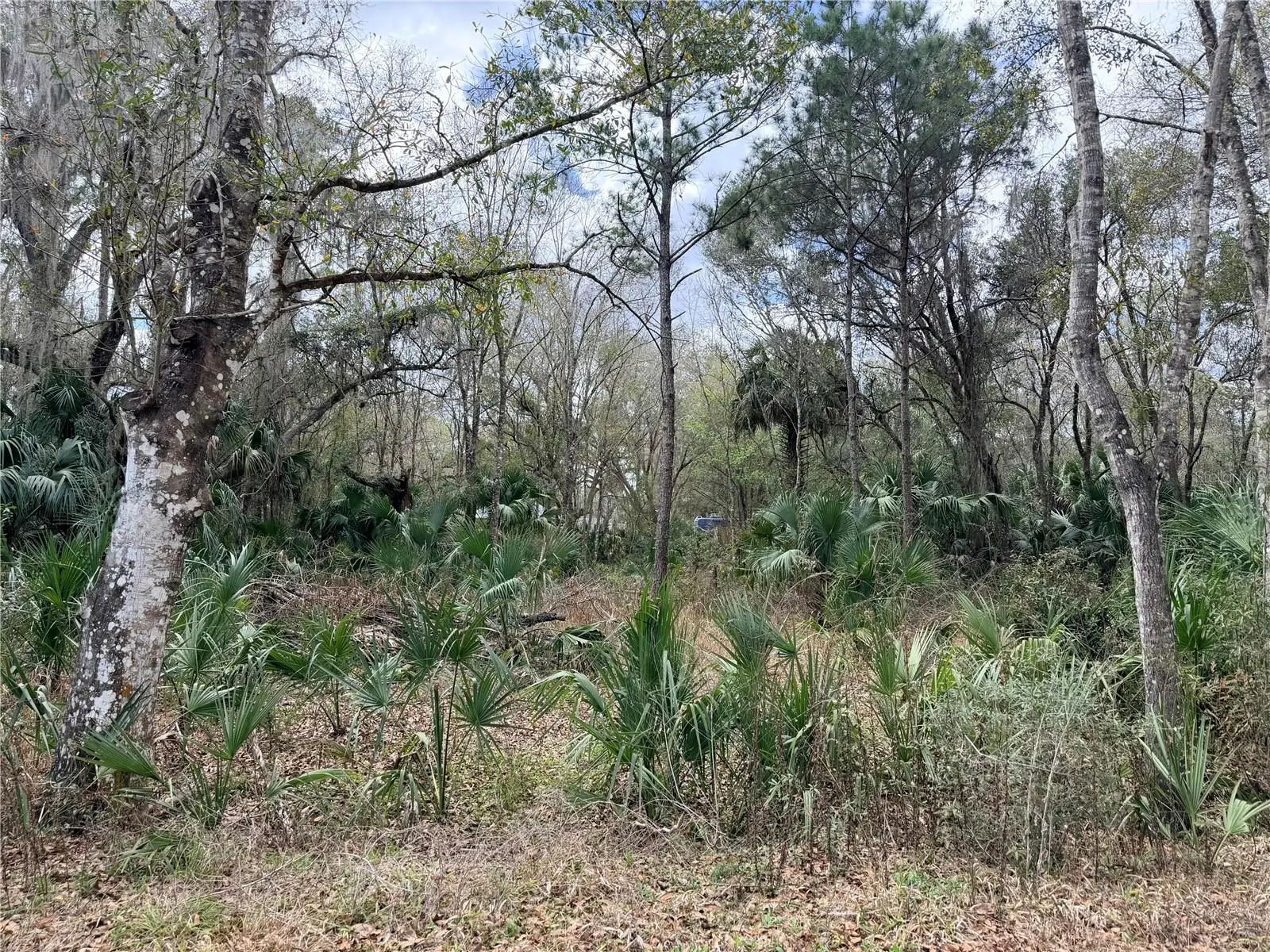
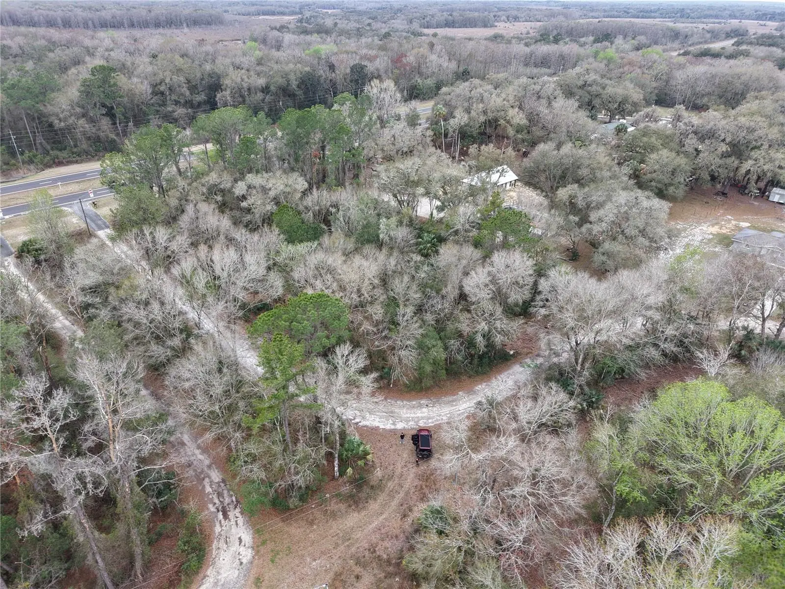
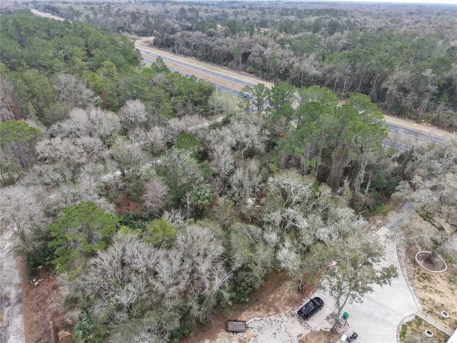
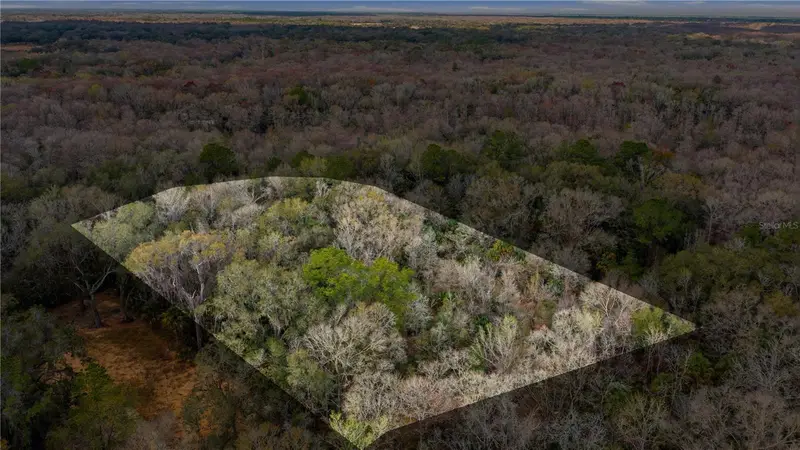
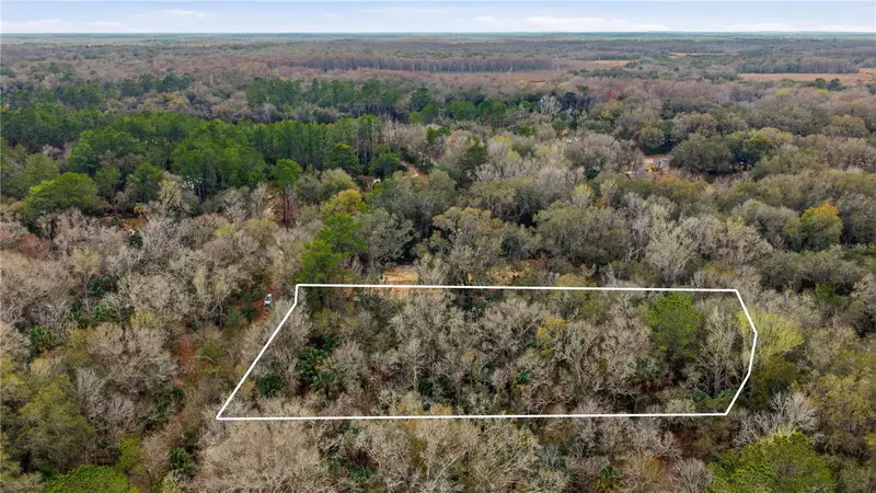
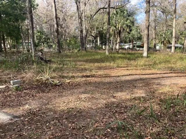
The corner lot has power across the street, and you have direct road frontage on Gulf to Lake Highway. Discover the exceptional 1.67-acre property situated in the heart of Inverness. Nestled in a serene environment, this hidden treasure offers an ideal combination of seclusion and accessibility, providing a perfect foundation for your envisioned lifestyle. Ideally positioned to The Villages and near Inverness's amenities, including shopping, dining, premier medical services, pristine lakes, and the renowned Withlacoochee Bike Trail, with easy access to I-75. Seize this unique opportunity to claim your piece of paradise in Inverness. Contact us today to arrange your private tour
Estimated monthly payment
Estimate only. Taxes use the listing's reported amount where available; insurance is a Florida-average estimate. Your actual payment will vary — run a full calculation or talk to a lender.
Price & listing history179 days on market
- Status: ActiveMar 2, 2026
- Listed$81,500Mar 2, 2026
- Price reduced$60,000
Facts & features
- Property type
- Land
- Status
- Active
- Days on market
- 179
- Subdivision
- Canal Acres
- County
- Citrus
- Price/sq ft
- $1
- Lot size
- 72,745 sq ft
- Lot category
- 1 to less than 2
- Flood zone
- AE
- Annual taxes
- $812 (2025)
- Parcel #
- 21E19S07 11000 0030
- Zoning
- R1
- MLS #
- G5108952
Ask about this home
Have a question? Ask the broker directly.
Ryan Solberg answers personally — no call center, no spam. Your question goes straight to him.
HOA & Financial
- Total monthly fees
- $0/mo
- Total annual fees
- $0
- Listing terms
- Cash, Conventional, Other
- Ownership
- Fee Simple
Exterior & Construction
- Road surface
- Limerock
Utilities
- Sewer
- None, Septic Needed
- Water source
- Well Required
- Utilities
- Electrical Nearby
Community
- Pets allowed
- Yes
Listing Details
- Listing date
- 2026-03-02
- On market date
- 2026-03-02
- Original list price
- $81,500
- MLS area
- 34450 - Inverness
- Listing AOR
- Orlando Regional
- Status changed
- 2026-03-02
- Tax legal description
- CANAL ACRES UNREC SUB MAP 666A LOT 3: COM AT NE COR OF SEC 7-19-21, TN S 0 DEG 13M 40S E AL E BDRY OF SEC 7 2467.16 FT TO N'LY R/W LN OF SR NO. 44 (100 FT WD), TN S 89 DEG 19M 55S W AL N'LY R/W LN 666.62 FT TO P.C. OF CURVE CONCAVED S'LY H AVING CENT ANGLE OF 9 DEG 08M AND RAD OF 5779.63 FT, TN W'L Y AL AND WITH ARC OF CURVE 517.74 FT TO POB FOR THE FOLLOWI N G DESC: FROM POB CONT W'LY AL N'LY R/W LN OF SR NO. 44 AND A L ARC OF CURVE, S 83 DEG 06M 58S W 224.34 FT,TN N 4 DEG 5 0M 3 2S W 300.43 FT
Flood risk
FEMA Special Flood Hazard Area (1% annual-chance / “100-year” floodplain). Flood insurance is generally required by mortgage lenders.
Source: FEMA flood zone reported on the listing. Confirm current designation at FEMA Flood Map Service Center.
Location
Directions
From Hwy 44 turn onto S Sickle lots on the left
More homes like this
$64,900
598 S Chambers Way
Inverness, FL 34450
1.22 acres
Canal Acres
MLS ID #OM726356, MAGNOLIA HOMES AND LAND LLC.
Listing provided by Stellar MLS
$40,000
2456 N Jungle Camp Rd #1
Inverness, FL 34453
1.03 acres
Newman Heights Unit 1
MLS ID #TB8536364, ERA AMERICAN SUNCOAST REALTY.
Listing provided by Stellar MLS
$44,900
2550 S Bali Pt
Inverness, FL 34450
0.61 acres
Baymeadows/7 Lakes
MLS ID #OM703521, TROPIC SHORES REALTY.
Listing provided by Stellar MLS
$78,000
8806 E Sweetwater Dr
Inverness, FL 34450
2.6 acres
Sweetwater Pointe
MLS ID #G5116430, FLORIDA REALTY INVESTMENTS.
Listing provided by Stellar MLS

Listings courtesy of Stellar MLS as distributed by MLS GRID
IDX information is provided exclusively for consumers’ personal, non-commercial use and may not be used for any purpose other than to identify prospective properties consumers may be interested in purchasing.
Based on information submitted to the MLS GRID as of August 28, 2026 at 7:42 AM ET. All data is obtained from various sources and may not have been verified by broker or MLS GRID. Supplied Open House Information is subject to change without notice. All information should be independently reviewed and verified for accuracy. Properties may or may not be listed by the office/agent presenting the information.
All or a portion of the multiple listing information is provided by Stellar MLS, from a copyrighted compilation of listings. The compilation of listings and each individual listing are © 2026 Stellar MLS. All rights reserved.
Ryan Solberg, Broker · MaxLife Realty LLC · FL License #BK3354351 · Equal Housing Opportunity · Full disclaimer · DMCA