$17,000
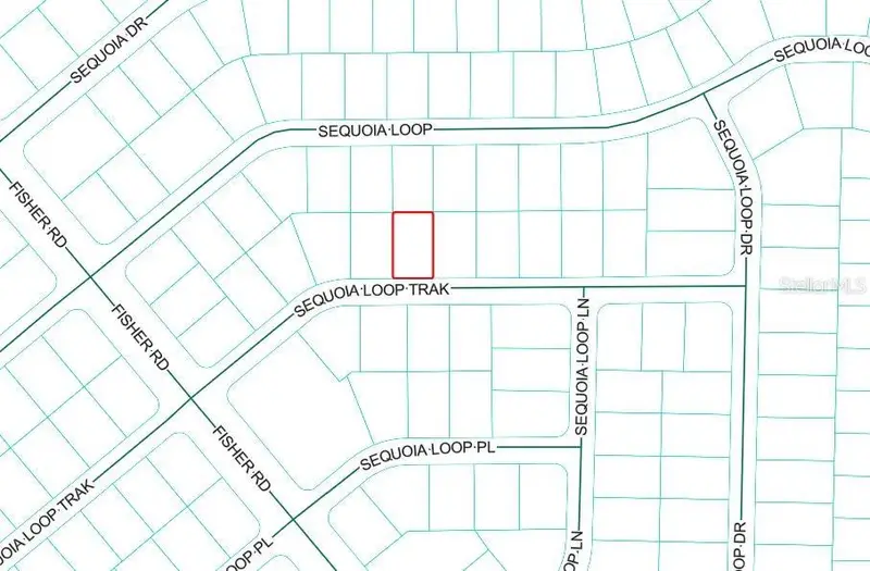
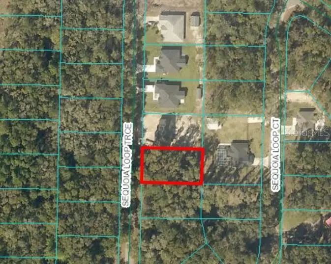
Tbd Sequoia Loop
Ocklawaha, FL 32179
Listing updated: June 9, 2026 at 12:06 PM ET
Property type
Lot size
Price / sq ft
HOA dues
Days on market
Flood zone
About this home
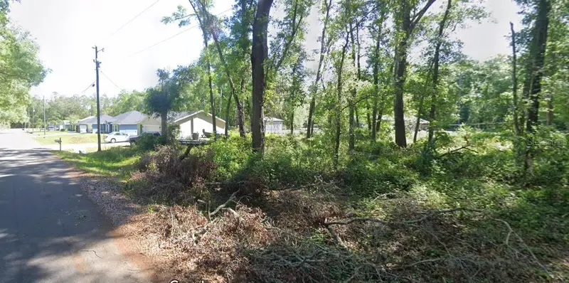
0.36 acre wooded lot in booming area of new construction homes. This property is close to the Ocklawaha River and is even walking distance to Moss Bluff Dam which has a park and recreation area for fishing, picnics, etc. Close to the famous Dam Diner restaurant and only a short distance to Lake Weir. Easy access to The Villages and Ocala. Property is zoned R-1 for site built homes.
Estimated monthly payment
Estimate only. Taxes use the listing's reported amount where available; insurance is a Florida-average estimate. Your actual payment will vary — run a full calculation or talk to a lender.
Price & listing history0 days on market
- Status: ActiveJun 9, 2026
- Listed$17,000Jun 9, 2026
- Price increased$17,000
Facts & features
- Property type
- Land
- Status
- Active
- Days on market
- 0
- Subdivision
- Silver Spgs Shores Un #44
- County
- Marion
- Price/sq ft
- $1
- Lot size
- 15,682 sq ft
- Lot category
- 1/4 to less than 1/2
- Flood zone
- X
- Annual taxes
- $133 (2025)
- Parcel #
- 9044-1568-18
- Zoning
- R1
- MLS #
- OM726283
Ask about this home
Have a question? Ask the broker directly.
Ryan Solberg answers personally — no call center, no spam. Your question goes straight to him.
HOA & Financial
- Total monthly fees
- $0/mo
- Total annual fees
- $0
- Listing terms
- Cash
- Ownership
- Fee Simple
Exterior & Construction
- Road surface
- Asphalt, Paved
Utilities
- Sewer
- None
- Water source
- None
- Utilities
- Electrical Nearby
Listing Details
- Listing date
- 2026-06-09
- On market date
- 2026-06-09
- Original list price
- $17,000
- MLS area
- 32179 - Ocklawaha
- Listing AOR
- Ocala - Marion
- Status changed
- 2026-06-09
- Tax legal description
- SEC 26 TWP 16 RGE 24 PLAT BOOK J PAGE 368 SILVER SPRINGS SHORES UNIT 44 BLK 1568 LOT 18
Flood risk
Minimal-risk area outside the mapped floodplain. Flood insurance is optional and typically low-cost.
Source: FEMA flood zone reported on the listing. Confirm current designation at FEMA Flood Map Service Center.
Location
Directions
From the intersection of Hwy 25 and Hwy 42 in Weirsdale, head North on Hwy 25, Right on Bay Rd, Right on SE 113th St Rd, Left on Fisher Rd, Right on Sequoia Loop, property is on the Left.
More homes like this
$17,500
Sequoia Loop Trak
Ocklawaha, FL 32179
0.23 acres
Silver Spgs Shores Un #44
MLS# OM718544
$19,000
17 Sequoia Loop Trce
Ocklawaha, FL 32179
0.26 acres
Silver Spgs Shores Un #44
MLS# O6324939
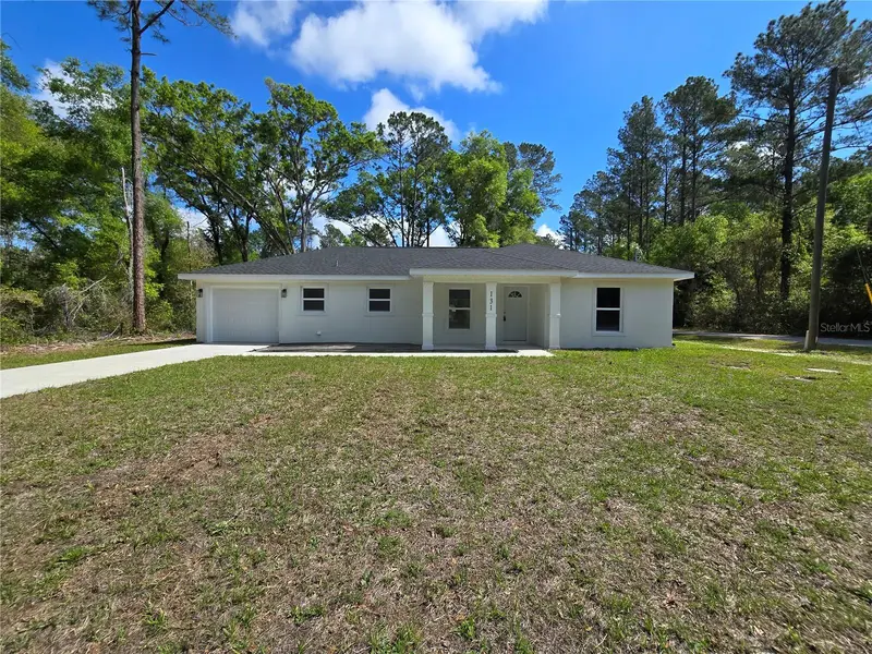
$245,000
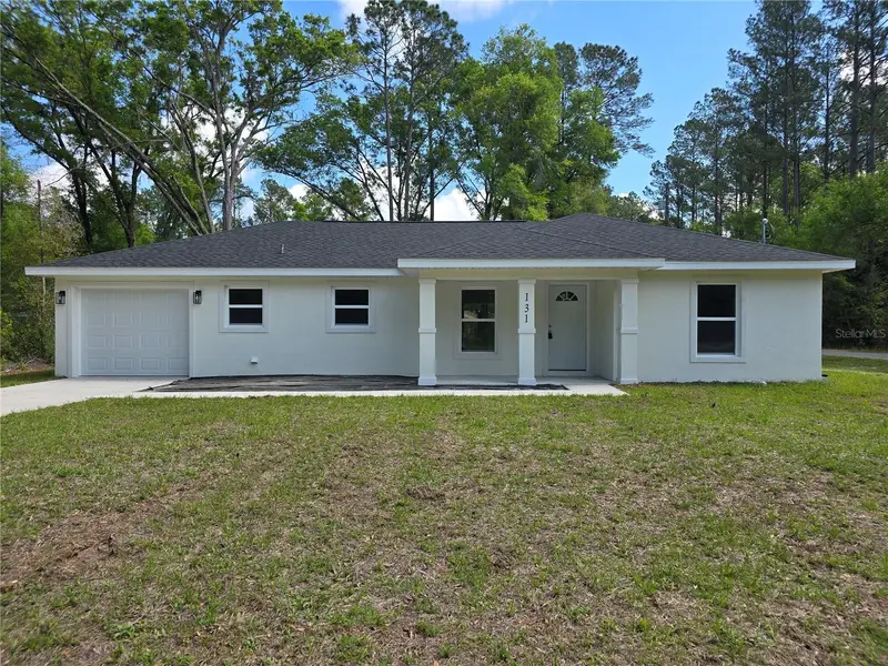
131 Fisher Rd
Ocklawaha, FL 32179
3 bd · 2 ba · 1,310 sqft
Silver Spgs Shores Un #44
MLS# OM717563
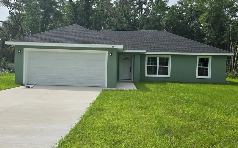
$255,000
30 Sequoia Drive Trce
Ocklawaha, FL 32179
3 bd · 2 ba · 1,380 sqft
Silver Spgs Shores Un #44
MLS# OM726232
Listings courtesy of Stellar MLS as distributed by MLS GRID
IDX information is provided exclusively for consumers’ personal, non-commercial use and may not be used for any purpose other than to identify prospective properties consumers may be interested in purchasing.
Based on information submitted to the MLS GRID as of June 9, 2026 at 12:06 PM ET. All data is obtained from various sources and may not have been verified by broker or MLS GRID. Supplied Open House Information is subject to change without notice. All information should be independently reviewed and verified for accuracy. Properties may or may not be listed by the office/agent presenting the information.
Ryan Solberg, Broker · MaxLife Realty LLC · FL License #BK3354351 · Equal Housing Opportunity · Full disclaimer · DMCA