$57,000
3601 20th Place
Ocala, FL 34470
Listing updated: July 15, 2026 at 3:01 PM ET
Property type
Lot size
Price / sq ft
HOA dues
Days on market
Flood zone
About this home
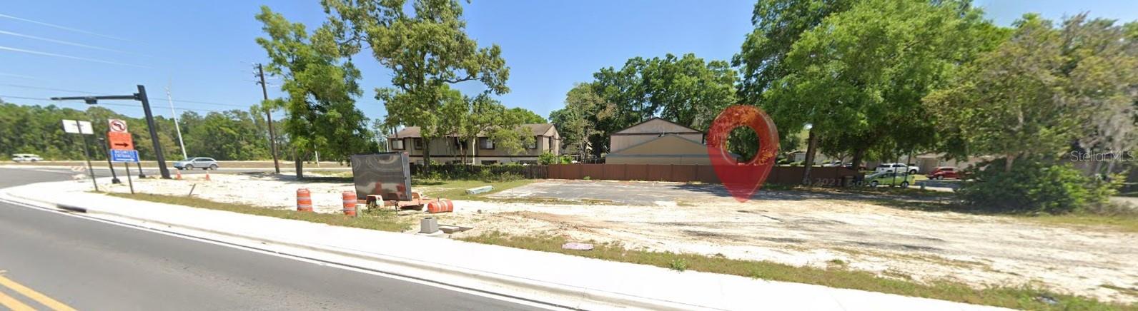
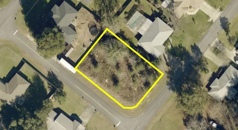
Unlock the potential of this multi-family zoned lot in Ocala, FL—a prime opportunity for investors and builders looking to capitalize on the area’s rapid growth. With zoning that allows for multiple units, this property is ideal for townhomes, duplexes, or a small rental development. Conveniently located near shopping, dining, schools, and major roadways, this lot offers both accessibility and strong rental demand. Whether you’re planning your next build or adding to your portfolio, this property provides the flexibility and upside you’re looking for. Don’t miss your chance to secure a development-ready lot in one of Central Florida’s fastest-growing markets!
Estimated monthly payment
Estimate only. Taxes use the listing's reported amount where available; insurance is a Florida-average estimate. Your actual payment will vary — run a full calculation or talk to a lender.
Price & listing history82 days on market
- Status: ActiveApr 24, 2026
- Listed$94,000Apr 24, 2026
- Price reduced$57,000
Facts & features
- Property type
- Land
- Status
- Active
- Days on market
- 82
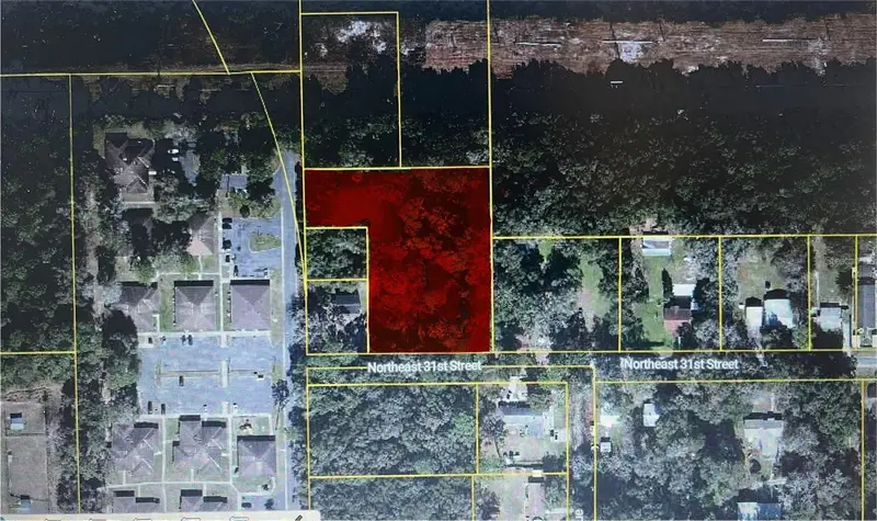
- Subdivision
- Villas Of Village West Ph 01 02 03
- County
- Marion
- Price/sq ft
- $6
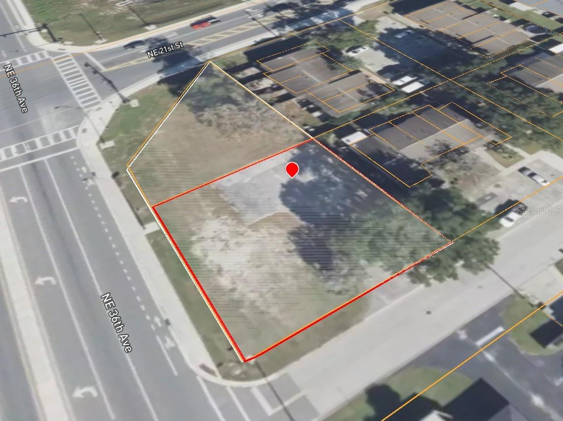
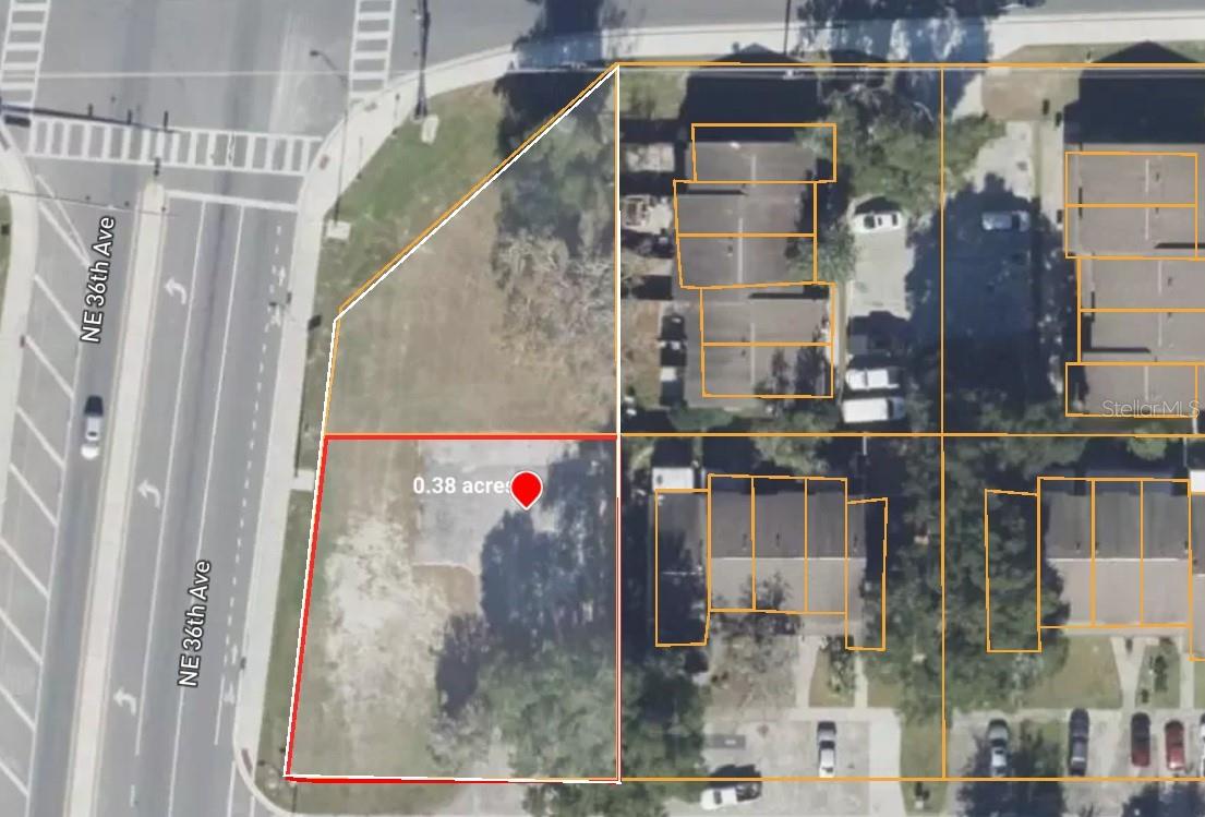
- Lot size
- 10,019 sq ft
- Lot category
- 0 to less than 1/4
- Flood zone
- X (12083C0529E)
- Annual taxes
- $608 (2025)
- Parcel #
- 27267-001-06
- Zoning
- PD16
- MLS #
- TB8501709
Ask about this home
Have a question? Ask the broker directly.
Ryan Solberg answers personally — no call center, no spam. Your question goes straight to him.
HOA & Financial
- Total monthly fees
- $0/mo
- Total annual fees
- $0
- Ownership
- Co-op
Exterior & Construction
- Road surface
- Paved
Utilities
- Sewer
- Public Sewer
- Water source
- Public
- Utilities
- Electricity Available, Public, Sewer Available, Water Available
Listing Details
- Listing date
- 2026-04-24
- On market date
- 2026-04-24
- Original list price
- $94,000
- MLS area
- 34470 - Ocala
- Listing AOR
- Suncoast Tampa
- Status changed
- 2026-04-24
- Tax legal description
- SEC 11 TWP 15 RGE 22 PLAT BOOK U PAGE 045 VILLAGE WEST BLK A LOT 6 EXCEPT THAT PART TAKEN FOR NE 36TH AVE DESC AS FOLLOWS: COM AT N 1/4 COR OF SEC 11 TH N 89-39-56 W 2637.79 FT TH S 00-01-24 W 144.59 FT TH S 89-49-26 E 41 FT FOR POB TH S 89-49-26 E 3 5.34 FT TH S 07-21-35 W 15.38 FT TO BEG OF CURVE CONCAVE ELY & HAVING RAD OF 3764.72 FT TH SLY ALG CURVE THROUGH A CENTRAL ANGLE OF 01-21-45 AN ARC DIS OF 89.53 FT TO PT LYING ON ELY EXISTING ROW & WLY LINE OF LOT 6 BEING ON CURVE CONCAVE NELY & HAV I NG A RAD OF 30 FT TH FROM TANGENT BEARING OF N 76-50-37 W RUN NWLY ALG ELY ROW & WLY LINE AND SAID CURVE THROUGH A CENTRAL ANGLE OF 77-00-17 AN ARC DIS OF 40.32 FT TO PT OF TANGNCY TH N 00-09-40 E 74.99 FT TO POB.
Flood risk
Minimal-risk area outside the mapped floodplain. Flood insurance is optional and typically low-cost.
Source: FEMA flood zone reported on the listing. Confirm current designation at FEMA Flood Map Service Center.
Location
Directions
Start in downtown Ocala and head north on US-27 / US-301 / US-441 (N Pine Ave). Continue north for about 10–12 miles. Take a left onto W Hwy 326 (if coming from central Ocala, this is a common connector). Follow local roads toward the parcel’s specific subdivision (you’ll likely transition onto smaller residential roads depending on exact lot placement). Use GPS with the parcel ID or coordinates to pinpoint the exact lot location once you’re nearby. Estimated drive time: ~20–25 minutes Distance: ~12–15 miles
More homes like this
$43,500
Tbd Redwood Track Crse
Ocala, FL 34472
0.23 acres
Silver Spgs Shores Un 26
MLS ID #OM728354, RE/MAX FOXFIRE - HWY 40.
Listing provided by Stellar MLS
$75,000
900 Nw 42nd Pl
Ocala, FL 34475
2 bd · 1 ba · 960 sqft
Stone Oaks
MLS ID #OM727776, RE/MAX FOXFIRE - HWY 40.
Listing provided by Stellar MLS
$60,000
0 Almond Dr
Ocala, FL 34472
0.25 acres
Slvr Spgs Sh N
MLS ID #OM727014, BUSCH REALTY.
Listing provided by Stellar MLS
$69,900
521 Ne 31st St
Ocala, FL 34479
1.91 acres
Twp 15
MLS ID #OM711000, CROWN & GLORY REALTY INC.
Listing provided by Stellar MLS
Listings courtesy of Stellar MLS as distributed by MLS GRID
IDX information is provided exclusively for consumers’ personal, non-commercial use and may not be used for any purpose other than to identify prospective properties consumers may be interested in purchasing.
Based on information submitted to the MLS GRID as of July 15, 2026 at 3:01 PM ET. All data is obtained from various sources and may not have been verified by broker or MLS GRID. Supplied Open House Information is subject to change without notice. All information should be independently reviewed and verified for accuracy. Properties may or may not be listed by the office/agent presenting the information.
All or a portion of the multiple listing information is provided by Stellar MLS, from a copyrighted compilation of listings. The compilation of listings and each individual listing are © 2026 Stellar MLS. All rights reserved.
Ryan Solberg, Broker · MaxLife Realty LLC · FL License #BK3354351 · Equal Housing Opportunity · Full disclaimer · DMCA