

$950,000
605-625 State Road 44
Leesburg, FL 34748
Listing updated: July 28, 2026 at 4:39 PM ET
Property type
Lot size
Price / sq ft
HOA dues
Days on market
Flood zone
About this home
3.11 +/- acres per 2008 survey with 870’ frontage on SR 44. Excellent visibility, less than a mile to The Villages. Located east of CR 468, MorseBlvd. and The Villages BOOMING expansion area. Lake Deaton Plaza is 1.5 miles west of this location with Publix, Campus USA Credit Union,Walgreens, Chase Bank, Piesanos Stone Fired Pizza, Circle K and more. Property is an out parcel to entrance of Pennbrooke Fairways, with 1,200 homes on 538 acres, a 55+ community. City utilities nearby and community water possibility. FLU Codes: Rural Transition, Zoning: CP Planned Commercial. AADT 25,000 cars per day (FDOT).
Estimated monthly payment
Estimate only. Taxes use the listing's reported amount where available; insurance is a Florida-average estimate. Your actual payment will vary — run a full calculation or talk to a lender.
Price & listing history288 days on market
- Status: ActiveOct 13, 2025
- Listed$950,000Oct 13, 2025
- Price increased$950,000
Facts & features
- Property type
- Land
- Status
- Active
- Days on market
- 288
- County
- Lake
- Price/sq ft
- $91
- Lot size
- 10,454 sq ft
- Lot category
- 2 to less than 5
- Flood zone
- X
- Annual taxes
- $370 (2024)
- Parcel #
- 19-19-24-0004-000-01601
- Zoning
- CP
- MLS #
- G5103261
Ask about this home
Have a question? Ask the broker directly.
Ryan Solberg answers personally — no call center, no spam. Your question goes straight to him.
HOA & Financial
- Total monthly fees
- $0/mo
- Total annual fees
- $0
- Ownership
- Other
Exterior & Construction
- Road surface
- Asphalt
Utilities
- Sewer
- Public Sewer
- Water source
- Public
- Utilities
- BB/HS Internet Available, Cable Available, Electricity Available, Sewer Available, Water Available
Listing Details
- Listing date
- 2025-10-13
- On market date
- 2025-10-13
- Original list price
- $950,000
- MLS area
- 34748 - Leesburg
- Listing AOR
- Ocala - Marion
- Status changed
- 2025-10-13
- Tax legal description
- FROM SW COR OF SE 1/4 RUN S 89-45-11 E 616.77 FT N 0-17-51 E PARALLEL TO W LINE OF SE 1/4 1384.21 FT TO N R/W LINE OF SR 44 FOR POB RUN N 15-54-30 E TO S'LY R/W OF SCL RR NW'LY ALONG R/W 100 FT BEG AGAIN AT POB RUN NW'LY ALONG N R/W LINE OF SR 44 A DIST OF 100 FT NE'LY 115 FT TO INTERSECT FIRST LINE ORB 3590 PG 2306
Flood risk
Minimal-risk area outside the mapped floodplain. Flood insurance is optional and typically low-cost.
Source: FEMA flood zone reported on the listing. Confirm current designation at FEMA Flood Map Service Center.
Location
Directions
SR 44 to signs on North side of road. Approximately 1.5 miles south of the Sumter County Line.
More homes like this
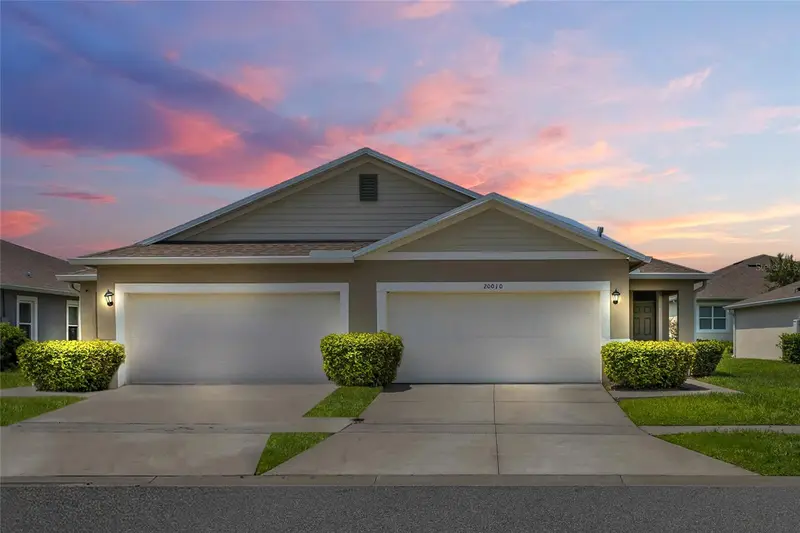
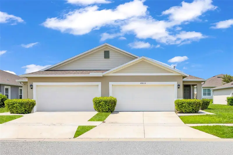
$263,000
20010 Royal Tern Ct
Leesburg, FL 34748
2 bd · 2 ba · 1,603 sqft
Lake Denham Estates
MLS ID #G5115662, KELLER WILLIAMS ELITE PARTNERS III REALTY.
Listing provided by Stellar MLS
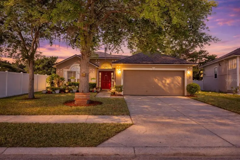
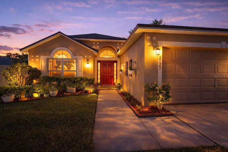
$294,900
2123 Anoka Way
Leesburg, FL 34748
3 bd · 2 ba · 1,612 sqft
Overlook/Lk Griffin
MLS ID #O6394935, REAL BROKER, LLC.
Listing provided by Stellar MLS
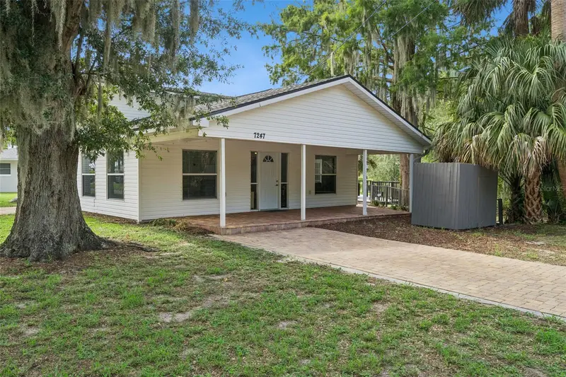
$380,000
7247 Treasure Island Rd
Leesburg, FL 34788
3 bd · 2 ba · 2,156 sqft
Treasure Island Shores
MLS ID #O6379876, KELLER WILLIAMS REALTY AT THE PARKS.
Listing provided by Stellar MLS
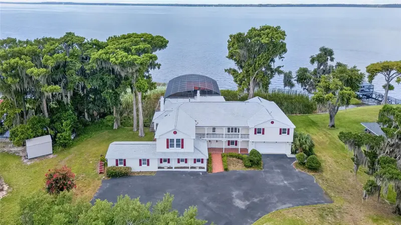
$1,600,000
1029 Mellathon Cir
Leesburg, FL 34748
7 bd · 8 ba · 5,878 sqft
Leesburg East Leesburg
MLS ID #O6419787, CHARLES RUTENBERG REALTY ORLANDO.
Listing provided by Stellar MLS
Listings courtesy of Stellar MLS as distributed by MLS GRID
IDX information is provided exclusively for consumers’ personal, non-commercial use and may not be used for any purpose other than to identify prospective properties consumers may be interested in purchasing.
Based on information submitted to the MLS GRID as of July 28, 2026 at 4:39 PM ET. All data is obtained from various sources and may not have been verified by broker or MLS GRID. Supplied Open House Information is subject to change without notice. All information should be independently reviewed and verified for accuracy. Properties may or may not be listed by the office/agent presenting the information.
All or a portion of the multiple listing information is provided by Stellar MLS, from a copyrighted compilation of listings. The compilation of listings and each individual listing are © 2026 Stellar MLS. All rights reserved.
Ryan Solberg, Broker · MaxLife Realty LLC · FL License #BK3354351 · Equal Housing Opportunity · Full disclaimer · DMCA