$849,000
2105 10th (Us Hwy 27) Street
Ocala, FL 34475
Listing updated: June 9, 2026 at 4:29 PM ET
Property type
Lot size
Price / sq ft
HOA dues
Days on market
Flood zone
About this home
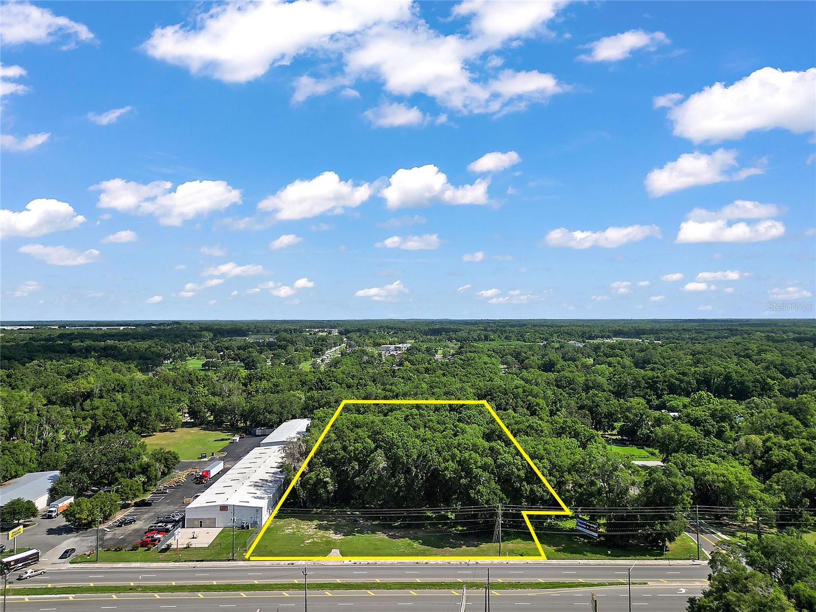
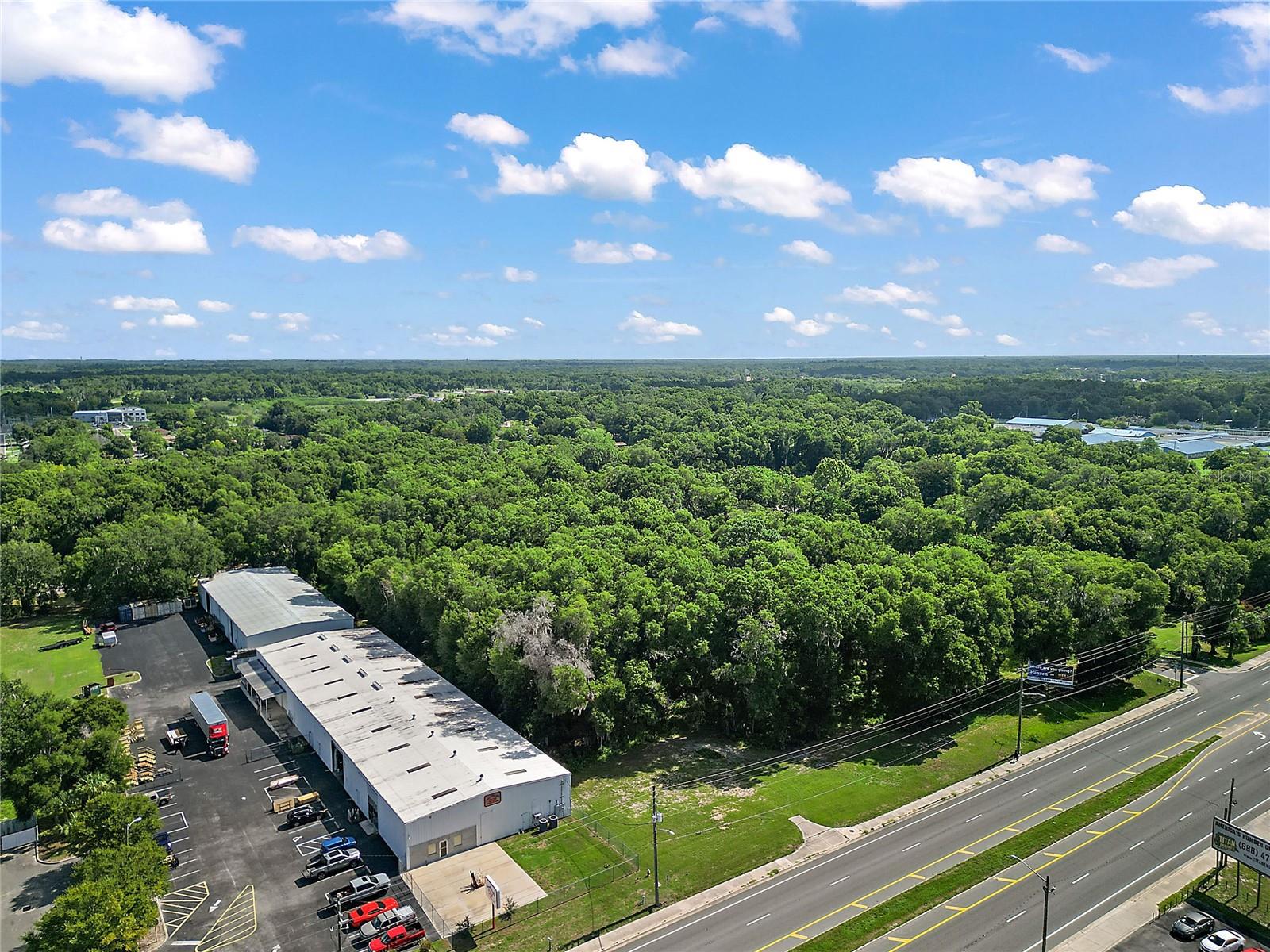
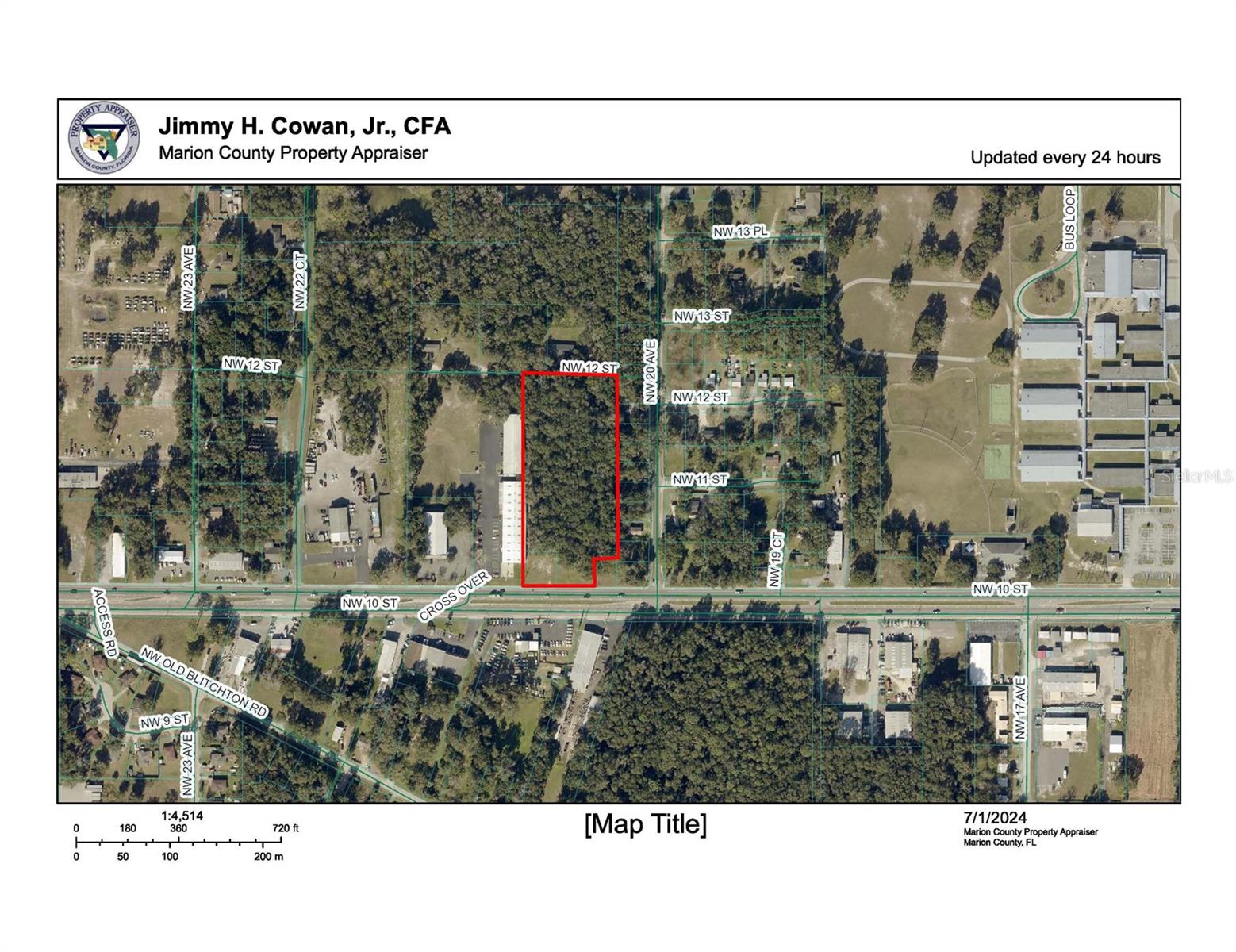
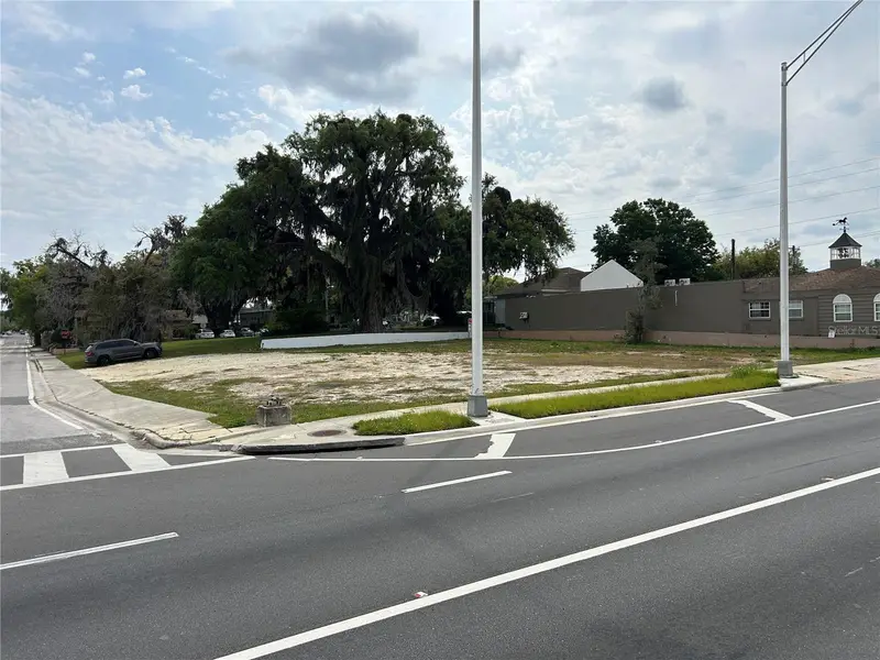
Offering is for 4.81+/- Acres directly on US Hwy 27, Zoned B4, City of Ocala, 22,000 FDOT avg trips per day, heavily wooded, with 101'FT +/- on Hwy 27/ NW 10th St. Site has excellent visibility with easy access. This location is minutes to busy downtown Ocala, World Equestrian, Exit 354 off I-75, US Hwy 301 or 441. Offering is an assemblage of 2 parcels 22231 & 22232. Bring your builder and walk this site. All information is believed accurate and correct but not guaranteed or warranted and subject to change without notice.
Estimated monthly payment
Estimate only. Taxes use the listing's reported amount where available; insurance is a Florida-average estimate. Your actual payment will vary — run a full calculation or talk to a lender.
Price & listing history691 days on market
- Status: ActiveJul 18, 2024
- Listed$849,000Jul 18, 2024
- Price increased$849,000
Facts & features
- Property type
- Land
- Status
- Active
- Days on market
- 691
- County
- Marion
- Price/sq ft
- $75
- Lot size
- 11,326 sq ft
- Lot category
- 2 to less than 5
- Flood zone
- X (12083C0508E)
- Annual taxes
- $453 (2023)
- Parcel #
- 22231-000-00
- Zoning
- B4
- MLS #
- G5084762
Ask about this home
Have a question? Ask the broker directly.
Ryan Solberg answers personally — no call center, no spam. Your question goes straight to him.
HOA & Financial
- Total monthly fees
- $0/mo
- Total annual fees
- $0
- Listing terms
- Cash, Conventional, Lease Purchase
- Ownership
- Fee Simple
Exterior & Construction
- Road surface
- Paved
Utilities
- Sewer
- Public Sewer
- Water source
- Public
- Utilities
- Electricity Available, Sewer Available, Water Available
Listing Details
- Listing date
- 2024-07-12
- On market date
- 2024-07-18
- Original list price
- $849,000
- MLS area
- 34475 - Ocala
- Listing AOR
- Lake and Sumter
- Status changed
- 2024-07-18
- Tax legal description
- SEC 12 TWP 15 RGE 21 COM SW COR OF NW 1/4 OF SE 1/4 TH E 358.7 FT TH N 6.41 FT FOR POB TH E 100 FT TH N 112 FT TH W 100 FT TH S 112 FT TO POB
Flood risk
Minimal-risk area outside the mapped floodplain. Flood insurance is optional and typically low-cost.
Source: FEMA flood zone reported on the listing. Confirm current designation at FEMA Flood Map Service Center.
Location
Directions
Leesburg go West on SR 44 to I-75, go North on I-75 to exit 354 & US Hwy 27 go East on US Hwy 27 property will be on the left look for sign
More homes like this
$595,000
2616 Sw 18th Ave Ne
Ocala, FL 34471
4 bd · 3 ba · 3,006 sqft
White Oak Village Ph 02
MLS ID #OM727362, KELLER WILLIAMS CORNERSTONE RE.
Listing provided by Stellar MLS
$899,000
5775 Sw 43rd Pl
Ocala, FL 34474
4 bd · 3 ba · 2,632 sqft
Hunt Club/Fox Point
MLS ID #OM714545, ROBERTS REAL ESTATE INC.
Listing provided by Stellar MLS
$685,000
3251 Sw 56th Ave
Ocala, FL 34474
4 bd · 2 ba · 2,244 sqft
Timberwood Add 03
MLS ID #OM725061, BRAVO'S PROPERTIES & MAN LLC.
Listing provided by Stellar MLS
$690,000
207 S Pine Ave
Ocala, FL 34471
0.6 acres
City/Ocala
MLS ID #OM725809, NAI HERITAGE, LLC.
Listing provided by Stellar MLS
Listings courtesy of Stellar MLS as distributed by MLS GRID
IDX information is provided exclusively for consumers’ personal, non-commercial use and may not be used for any purpose other than to identify prospective properties consumers may be interested in purchasing.
Based on information submitted to the MLS GRID as of June 9, 2026 at 4:29 PM ET. All data is obtained from various sources and may not have been verified by broker or MLS GRID. Supplied Open House Information is subject to change without notice. All information should be independently reviewed and verified for accuracy. Properties may or may not be listed by the office/agent presenting the information.
All or a portion of the multiple listing information is provided by Stellar MLS, from a copyrighted compilation of listings. The compilation of listings and each individual listing are © 2026 Stellar MLS. All rights reserved.
Ryan Solberg, Broker · MaxLife Realty LLC · FL License #BK3354351 · Equal Housing Opportunity · Full disclaimer · DMCA