$849,000
Tbd State Rd 200
Ocala, FL 34476
Listing updated: December 21, 2025 at 3:37 PM ET
Property type
Lot size
Price / sq ft
HOA dues
Days on market
Flood zone
About this home
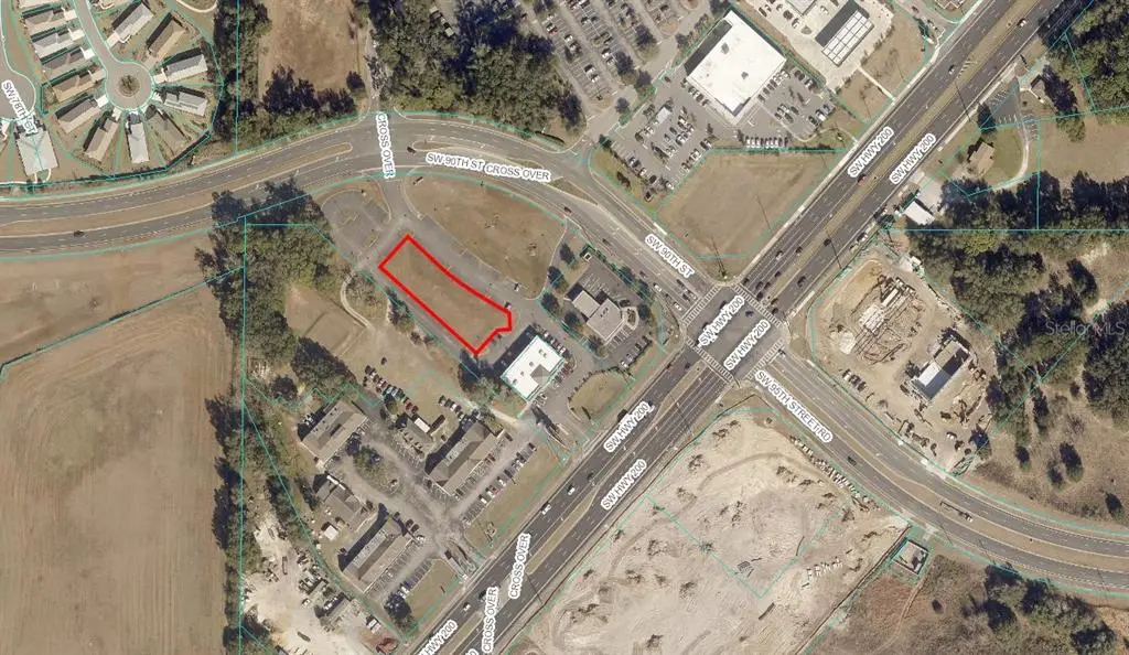
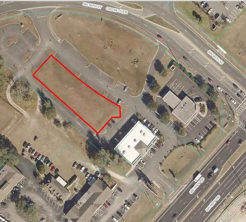
FULLY ENTITLED PAD FOR UP TO 18,600 SQ FT. LOCATED ON A HEAVILY TRAVELED HIGHWAY NEAR THE NEW LOWE'S. VACANT SITE INCLUDES A FULLY ENGINEERED BUILDING PLAN. PLENTY OF POTENTIAL FOR MANY BUSINESS TYPES AND GREAT INVESTMENT WITH PRIME LOCATION AND HIGH VISIBILITY.
Estimated monthly payment
Estimate only. Taxes use the listing's reported amount where available; insurance is a Florida-average estimate. Your actual payment will vary — run a full calculation or talk to a lender.
Price & listing history1152 days on market
- Status: ActiveOct 26, 2022
- Listed$849,000Oct 26, 2022
- Price increased$849,000
Facts & features
- Property type
- Land
- Status
- Active
- Days on market
- 1152
- County
- Marion
- Price/sq ft
- $41
- Lot size
- 20,909 sq ft
- Lot category
- 1/4 to less than 1/2
- Flood zone
- X
- Annual taxes
- $7,983 (2021)
- Parcel #
- 35694-007-00
- Zoning
- B4
- MLS #
- OM647804
Ask about this home
Have a question? Ask the broker directly.
Ryan Solberg answers personally — no call center, no spam. Your question goes straight to him.
HOA & Financial
- Total monthly fees
- $0/mo
- Total annual fees
- $0
- Listing terms
- Cash, Conventional
- Ownership
- Fee Simple
Exterior & Construction
- Road surface
- Asphalt, Paved
Utilities
- Sewer
- Public Sewer
- Water source
- Public
- Utilities
- Electricity Available, Phone Available, Public, Sewer Available, Water Available
Listing Details
- Listing date
- 2022-10-26
- On market date
- 2022-10-26
- Original list price
- $849,000
- MLS area
- 34476 - Ocala
- Listing AOR
- Ocala - Marion
- Status changed
- 2022-10-26
- Tax legal description
- SEC 19 TWP 16 RGE 21 MIDWAY 200 CENTER CONDOMINIUM AS RECORDED IN OR BK 5225 PAGE 58 UNIT 1 MORE FULLY DESC AS FOLLOWS: COM AT THE NW COR OF NE 1/4 OF NW 1/4 OF SEC 19 TWP 16 RGE 21 TH S 88-45-45 E 125.84 FT ALG THE N LINE TH DEPARTING SAID N LINE S 47-35-00 E 167.05 FT TH N 42-56-38 E 37.51 FT TO POB TH CONT N 42-56-38 E 77.35 FT TH S 47-04-46 E 73.29 FT TO A TANGENT INTERSECTION WITH A CIRCULAR CURVE, SAID CURVE BEING CONCAVE NLY AND HAVING A RAD OF 587.31 FT AND A CENTRAL ANGLE OF 10-50-27, T H ELY ALG THE ARC OF SAID CURVE 111.12 FT CH BEARING AND DIS FOR SAID CURVE BEING S 52-30-00 E 110.96 FT TH S 57-55-13 E 62.60 FT TH S 03-42-21 E 30.09 FT TH S 86-17-39 W 24 FT TH S 43-21-21 W 60.04 FT TH N 47-24-45 W 250.21 FT TO POB
Flood risk
Minimal-risk area outside the mapped floodplain. Flood insurance is optional and typically low-cost.
Source: FEMA flood zone reported on the listing. Confirm current designation at FEMA Flood Map Service Center.
Location
Directions
ON HWY 200 AT THE INTERSECTION OF SW 90TH STREET. PROPERTY ON CORNER BEHIND ALARION BANK
More homes like this
$279,000
5611 Ne 5th Pl
Ocala, FL 34470
3 bd · 2 ba · 1,314 sqft
Ocala Heights
MLS ID #OM726060, WALDEN & CO REALTY LLC.
Listing provided by Stellar MLS
$377,900
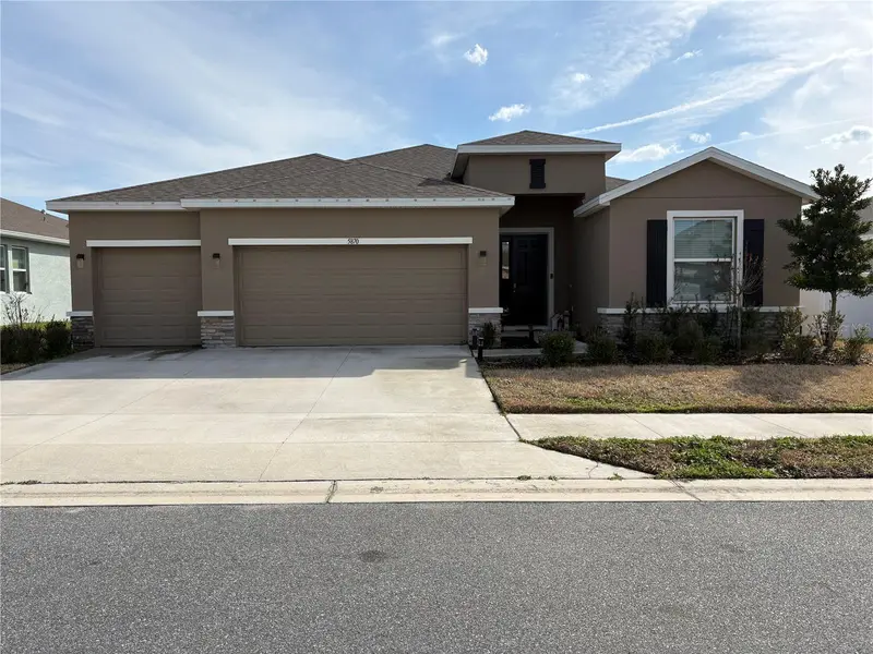
5870 Sw 80th Pl
Ocala, FL 34476
4 bd · 3 ba · 2,553 sqft
Brookhaven Ph 2
MLS ID #OM719277, FATHOM REALTY FL LLC.
Listing provided by Stellar MLS
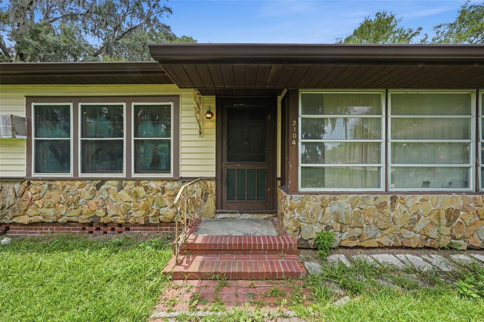
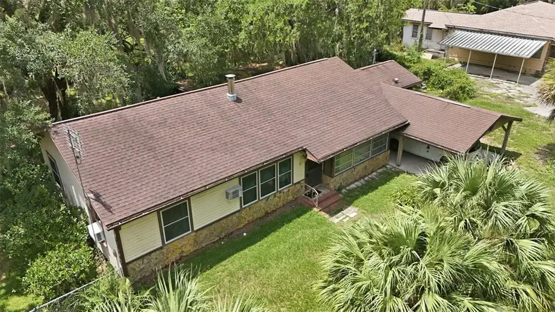
$198,000
2104 Se Lake Weir Ave
Ocala, FL 34471
3 bd · 1 ba · 1,832 sqft
Druid Hills
MLS ID #G5115849, DOWN HOME REALTY, LLLP.
Listing provided by Stellar MLS
$555,000
3612 Se 47th Ter
Ocala, FL 34480
3 bd · 3 ba · 2,513 sqft
Magnolia Manor
MLS ID #O6378776, LPT REALTY, LLC.
Listing provided by Stellar MLS
Listings courtesy of Stellar MLS as distributed by MLS GRID
IDX information is provided exclusively for consumers’ personal, non-commercial use and may not be used for any purpose other than to identify prospective properties consumers may be interested in purchasing.
Based on information submitted to the MLS GRID as of December 21, 2025 at 3:37 PM ET. All data is obtained from various sources and may not have been verified by broker or MLS GRID. Supplied Open House Information is subject to change without notice. All information should be independently reviewed and verified for accuracy. Properties may or may not be listed by the office/agent presenting the information.
All or a portion of the multiple listing information is provided by Stellar MLS, from a copyrighted compilation of listings. The compilation of listings and each individual listing are © 2026 Stellar MLS. All rights reserved.
Ryan Solberg, Broker · MaxLife Realty LLC · FL License #BK3354351 · Equal Housing Opportunity · Full disclaimer · DMCA